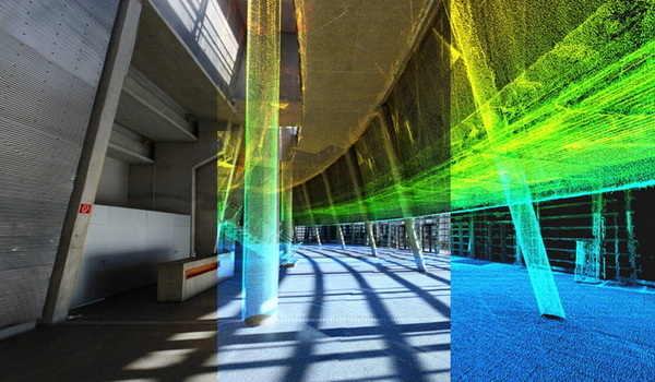
GET POINT CLOUD DATA AND START WORKING ON YOUR PROJECT
We conduct 3D laser scanning surveys of sites of all shapes and sizes. We are able to deliver point cloud data which can be then converted to 3D BIM models and 2D drawings. Full measured building surveys using point cloud data are infinitely more accurate. Therefore, more dependable across all that you do.
HOW IT WORKS
- We conduct a full 3D point cloud survey of the building
- We process and register surveyed scans using specialised 3d laser scanning software to create a single point cloud file, which we will then send on to you
- You can then open the point cloud data using Autodesk Recap or other relevant software to visualise the area and take any required measurements
- You can also import point cloud into BIM/CAD software and use it as a background reference to create accurate 2D drawings and 3D models